The road that parallels the
western boundary of the Addie
S Cabin and Mineral Claim as it heads south from Red Mountain
Pass is one of the most scenic and avalanche prone in the
country. Known today as US 550 and as The Million Dollar
Highway, it is part of the San Juan Scenic Skyway.
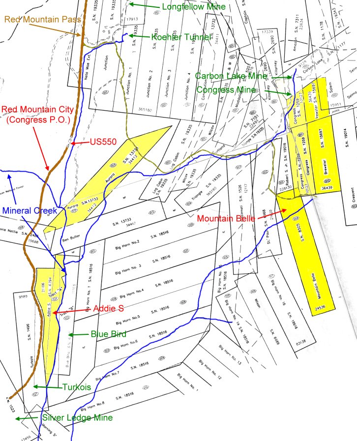
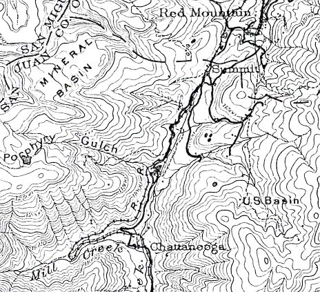
Patented Mining Claims Plat Map
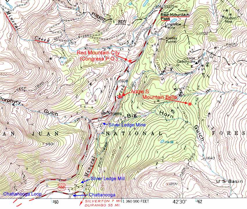
1972 Topo Map
1904 Topo Map
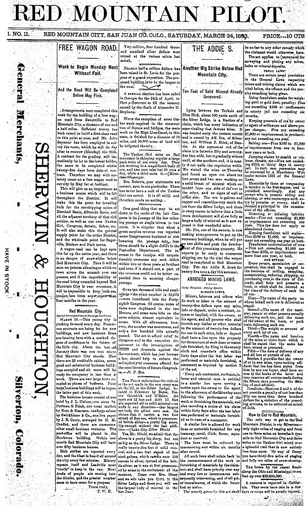
March 24, 1883. FREE
WAGON ROAD. Work to Begin Monday Next Without Fail. And the Road Will
Be Completed
Before May First.
Arrangements were completed this week for the building of a free wagon road
from Sweetville to Red Mountain
City, a distance of one and a
half miles. Sufficient money has been raised to build a first-class
road to this point at once, and Mr.
John Seymour has been employed
to survey the route, which he will do day after tomorrow (Monday) the 26th.
A contract for
grading will immediately be let
to the lowest bidder, the same to be completed within twenty-five days from
date of contract.
Therefore we may with certainty
count on a free wagon road to our city by May 1st at farthest. This
will give us an importance as
a business centre which will be
felt throughout the District. It will make this the point for breaking
bulk for the ore-shipping mines
of Marshall Basin, Silveride
Basin, and all the adjacent territory of that rich section, as well as our
own Yankee Girl, Congress,
Senate, Salem, etc. It
will also make this the general supply point for the entire District, and
the wholesale point for Rogerville,
Hudson and Park towns. A
wagon road can be kept open this far up the entire year, and there is no
danger of snow-slides below
Red Mountain City. Thus
it will be seen we possess advantages which no town across the summit ever
can possess, and if the
improbability of the road being
extended beyond Red Mountain City is ever overcome, it will be impossible to
keep such extensions
free from snow more than four
months in the year.
Until the above described attempt by the owners of the Congress to
build a dirt road from Red Mountain Pass as far as
Chattanooga, only rough pack
trails existed in the area and no road existed between Chattanooga and
Silverton. They did not
meet their schedule but the
rough road between Red Mountain City and the base of the grade was completed
in June 1883. It did
not, however, quite reach
either Red Mountain Pass or Chattanooga. It was
not until December, 1884, that the road opened
between Silverton and Red
Mountain Pass (and thus on to Ouray). Otto
Mears completed the alignment and grading of the road
with a future railroad
in mind. The twenty-two miles of road from Ouray to
Silverton was reputed to have cost about two hundred
thousand dollars. The
first stage came through from Ouray to Silverton in June
1885. Today it is part of the seventy miles of road
from Ouray to
Durango we know as the Million Dollar Highway. The dirt road was
upgraded for automobile traffic and re-aligned in
some locations between 1921 and
1924. By 1938 the only unpaved portion was from Rockwood to Ouray. By
1954 the only
sections not paved were over
Molas Divide and Red Mountain Pass. Red Mountain Pass was paved by 1955 and
Molas Divide by
1957. The average daily
traffic over the road at Red Mountain Pass in the year 2000 was 2610.
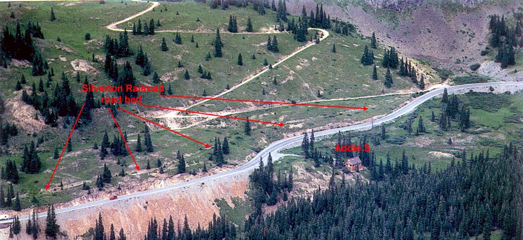
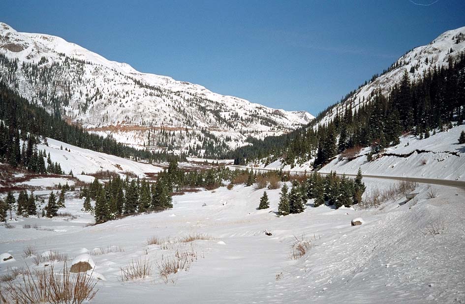
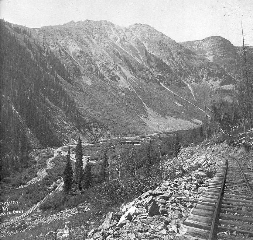
Highway heading north from
Silverton, Mineral Creek to left, Chattanooga in center, and grade above the
Chattanooga Loop beyond.
Addie S and Red Mountain Pass are just
to right of where road disappears.
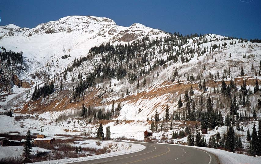
Chattanooga, at base of highway
before it climbs to the Addie
S and Red Mountain Pass. The sole current residence is
to the left
of the road and the sole
remaining loading building from the
Silver Ledge Mill is on the right of
the road.
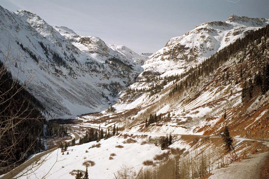
Chattanooga Loop of highway.
Note parallel railroad right-of-way above road.
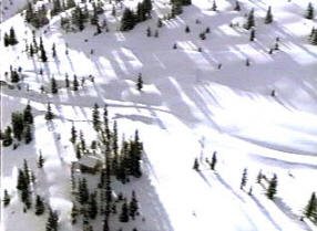
Click on image to start slow
loading, aerial movie clip
of the cabin and highway 550.