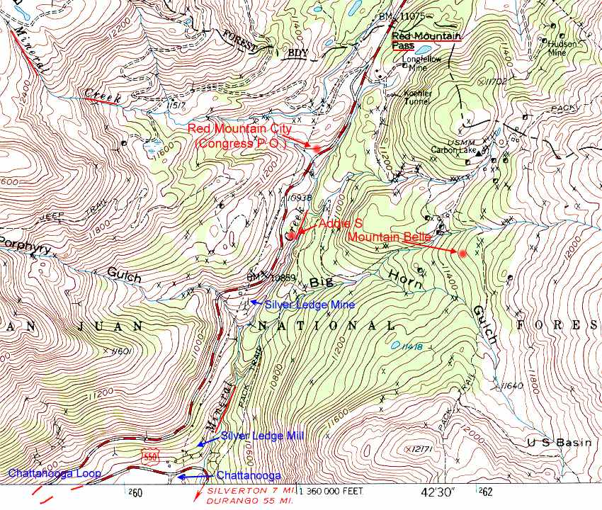
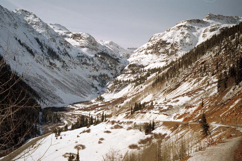
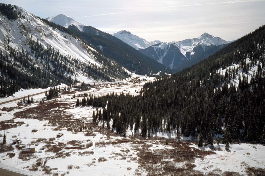
Location: Milepost
76,
Million Dollar Highway, US550, San Juan
County, Colorado
Click on images below to enlarge, BACK to return
here
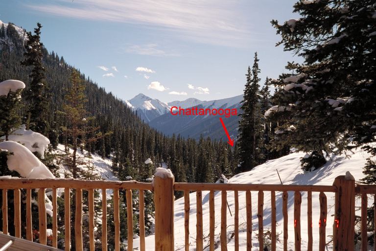
From the deck of the Addie S Cabin, Chattanooga is located beyond and below the trees indicated by the
point of the red arrow.
Patented Mining Claims Plat Map 1972 Topo Map
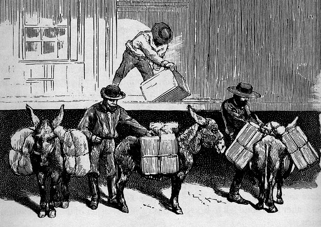
Before the
railroad arrived in Chattanooga, freight
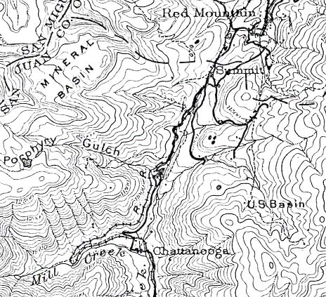
1904 Topo Map
was shipped by railroad to
Silverton, transferred by
wagons to Chattanooga and by to
burros or mules
for the rest of the journey
into the Red Mountain
District.
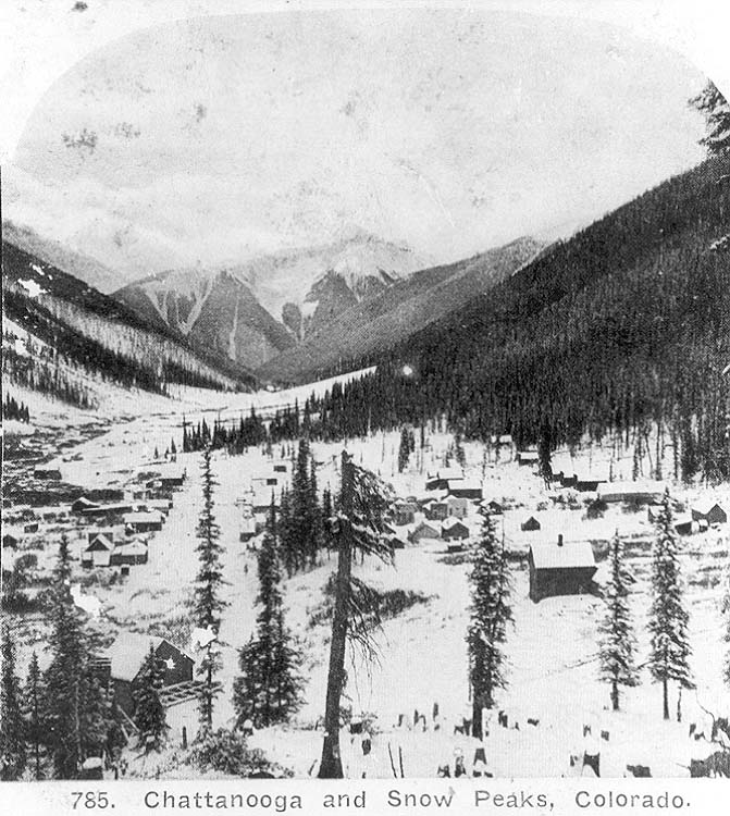
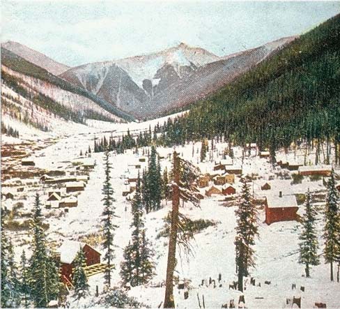
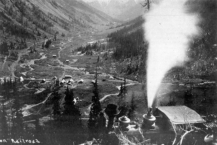
“In the above scene (taken from a
stereo card) the settlement of Chattanooga was in the midst of the winter
snows. Almost forty
cabins or houses were visible in the photograph.
Chattanooga was at the end of a long, gentle valley that ran from Silverton
to
the base of Red Mountain, so it exploded with activity when rich silver
discoveries were found on up the mountain. The town's
roads ran north and
south at the time and the Silverton Railroad had yet to arrive. The photo
was taken before 1888 when a
snow slide wiped out most of the town. The town
was then rebuilt with its few remaining streets being oriented east and
west.
The settlement was founded under the name "Sweetville" in 1883, but
its name had been changed to Chattanooga by the end
of the year. The town
was a supply point for the booming Red Mountain Mining District. A month
after its founding, Sweetville
already contained seventy-five structures in
some stage of construction, and its population was over 300. Supplies could
be
brought to this point by wagon and then transferred to mules or burros
for transport on up the mountain. After the Silverton
Railroad was
constructed through the town in 1888, the supplies no longer needed to be
transferred, and Chattanooga's
population went downhill quickly. The snow
slide finished it off. Then, to add insult to injury, what was left of the
town burned a
few years later."
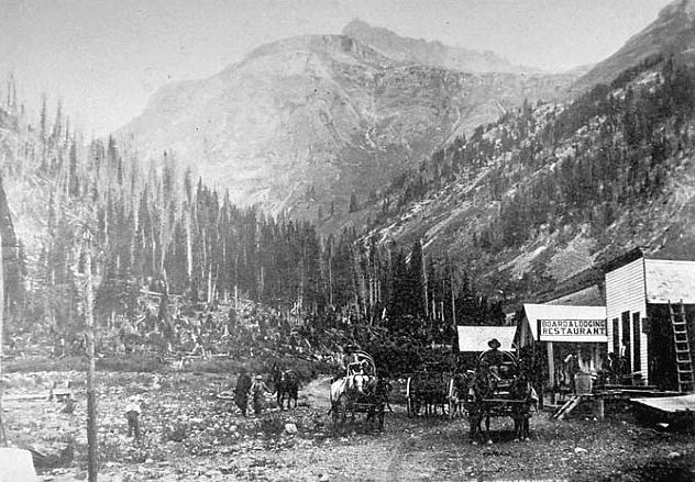
Chattanooga, 1883, before the railroad was
built
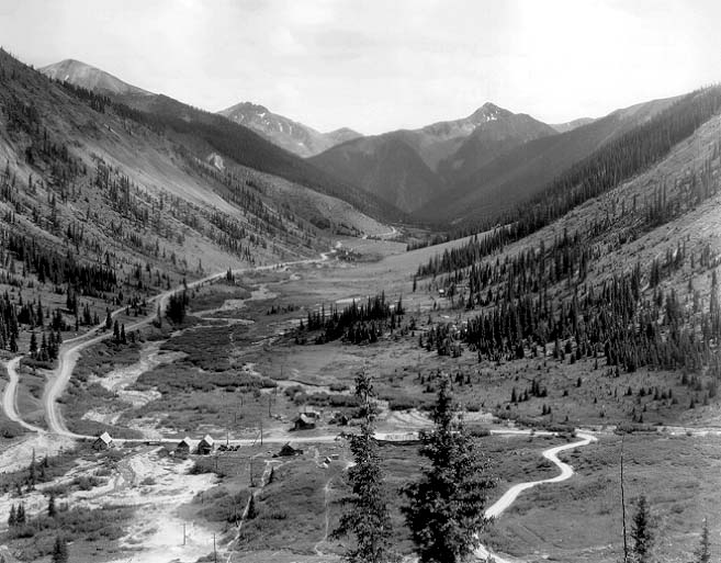
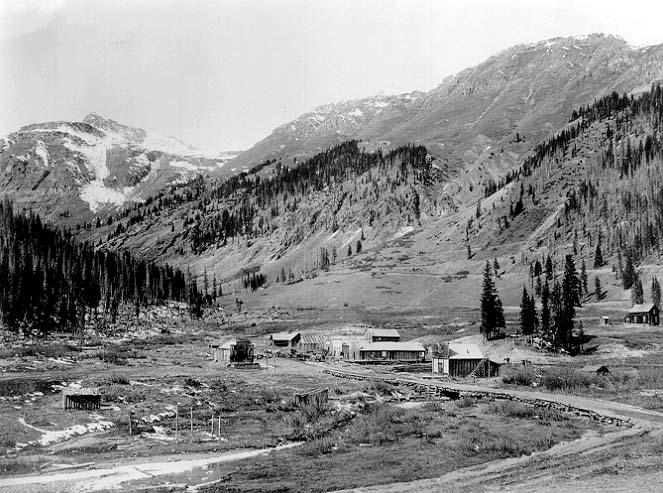
Date unknown. Post 1890, looking up Mill Creek.
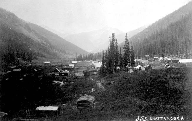
Chattanooga, 1887. 1889 or 1889 looking up Mill Creek. "This view shows the marginal
maintenance that came to characterize the settlement after its initial boom
years. Of the improvements remaining in this 1888
scene, only the ruins of
the bridge across Mineral Creek are in evidence today. While Chattanooga
served a purpose during its
first years from 1883-84, the town's decline was
precipitated by a couple of factors. One was the building of the Silverton
Railroad
from Silverton to the Red Mountain District, which didn't bypass
Chattanooga but which removed its significance as a point at
which pack
trains took over for wagons during the formative years of the district. The
grade of the railroad climbing to Red
Mountain Town [No. 2] and Ironton is
visible on the mountainside in the background. The community's other blow
was a March,
1884, avalanche from what residents called Independence
Mountain north of town, which destroyed several residential and
business
buildings; several others caved in from heavy snow that same winter. Without
any certainty, it is possible that
structures in this view may include (from
left to right) the old drug store of Dr. J. B. Smith (tapered false front at
left, facing the
camera, with a probable post office flag pole in front);
the Chattanooga House (farthest of the false fronts on the right side of the
street, with two-story lodging addition in the rear); and the former store
and lumber office erected for Frank Barnes by Asa
McGregor (building just
beyond the bridge with external stairway), which was described at the time
as being a story-and-a-half.
The large Chattanooga Concentrator - built in
1883 - would have been just out of the view at the right, served by a
loading spur
above the mainline of the Silverton Railroad at the time of the
photo."
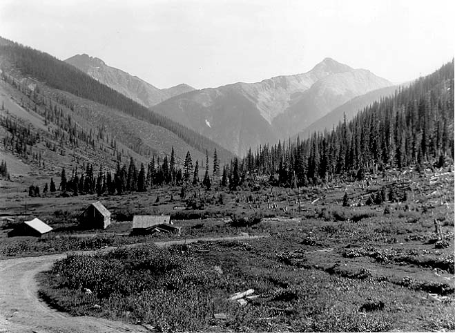
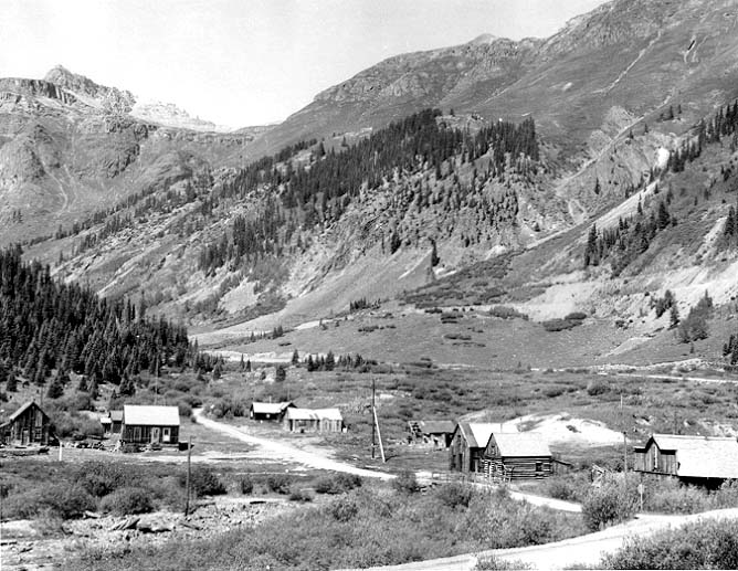
After 1889 avalanche.
Streets are oriented north
and south.